Sketchfab
3D Model
PaleoMap - Paleogeographic Maps
License & Attribution
Description
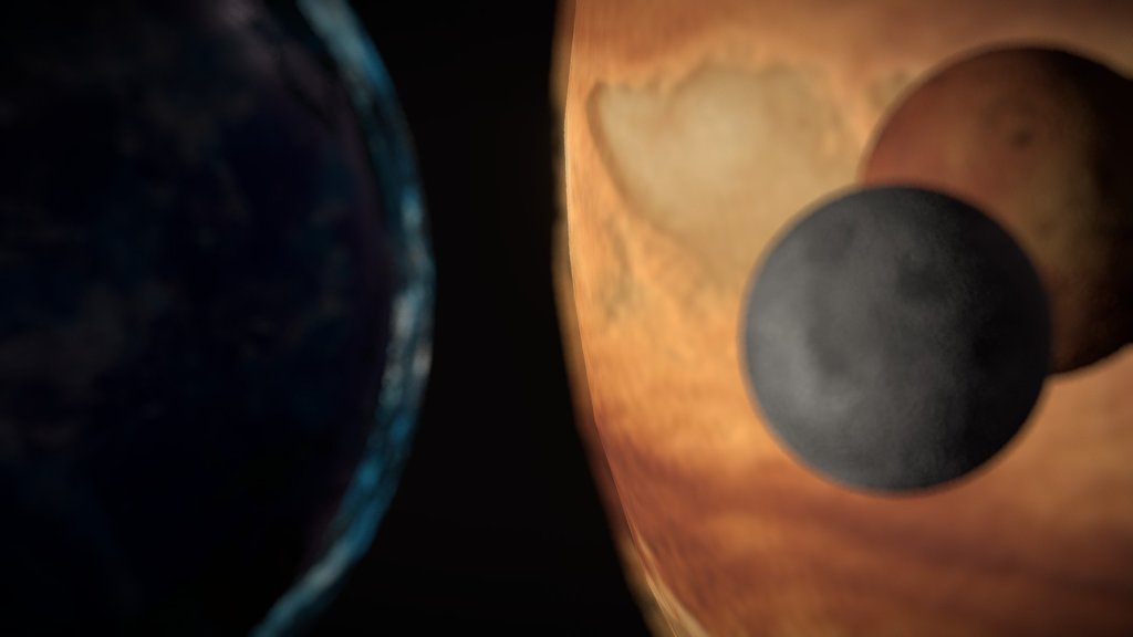
The paleogeographic maps in the PaleoAtlas illustrate the ancient configuration of the ocean basins and continents, as well as important topographic and bathymetric features such as mountains, lowlands, shallow sea, continental shelves, and deep oceans.
The paleoatlas consists of 91 paleogeographic maps spanning the late Neoproterozoic (~750 Ma) and Phanerozoic (present-day, 0 Ma).
Data from: Scotese, C.R., 2016. PALEOMAP PaleoAtlas for GPlates and the PaleoData Plotter Program, PALEOMAP Project.
Website: http://geology.uaic.ro/muzee/mineralogie/
Concept & 3D-modelling by dr. Andrei Ionut APOPEI
Sketchfab
3D Model
PaleoMap - Paleogeographic Maps
Share:
AI-Powered Productivity
Boost your creative workflow with seamless access to ChatGPT, Claude, Midjourney and other global AI platforms. We recommendTongbaofor one-click access to AI tools and remote collaboration platforms. Get 200MB free daily upon registration, supports Google Workspace, Notion, and more.
Asset Information
Type:
3D Model
Source:
Sketchfab
Profile:
View on Sketchfab
Download:
Available
Published:
June 26, 2020
License:
CC Attribution-NonCommercial-NoDerivs
Commercial Use
Check License
View on Sketchfab
Statistics
Downloads:
5,717
Likes:
103
Views:
28,586
Technical Specifications
Polygons:
812,160
Vertices:
406,260