Sketchfab
3D Model
PaleoMap - Paleogeographic Maps
许可证和归属
描述
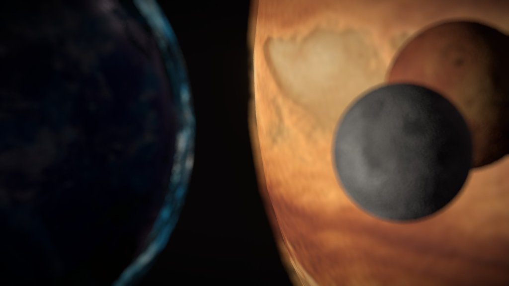
The paleogeographic maps in the PaleoAtlas illustrate the ancient configuration of the ocean basins and continents, as well as important topographic and bathymetric features such as mountains, lowlands, shallow sea, continental shelves, and deep oceans.
The paleoatlas consists of 91 paleogeographic maps spanning the late Neoproterozoic (~750 Ma) and Phanerozoic (present-day, 0 Ma).
Data from: Scotese, C.R., 2016. PALEOMAP PaleoAtlas for GPlates and the PaleoData Plotter Program, PALEOMAP Project.
Website: http://geology.uaic.ro/muzee/mineralogie/
Concept & 3D-modelling by dr. Andrei Ionut APOPEI
Sketchfab
3D Model
PaleoMap - Paleogeographic Maps
分享:
AI 智能办公推荐
搭配 AI 工具提升创作效率,流畅访问 ChatGPT、Claude、Midjourney 等海外 AI 平台。推荐使用通宝 (Tongbao)一键直连全球 AI 工具与协同办公平台。注册即享每日 200M 免费额度,支持 Google Workspace、Notion 等远程办公套件。
资源信息
类型:
3D Model
来源:
Sketchfab
下载:
可下载
发布时间:
June 26, 2020
许可证:
CC Attribution-NonCommercial-NoDerivs
商用许可
请查看许可证
在 Sketchfab 上查看
统计
下载次数:
5,717
点赞数:
103
浏览数:
28,586
技术规格
多边形数:
812,160
顶点数:
406,260