Sketchfab
3D Model
Milestone Realp - Witenwasserental Km 5.5
License & Attribution
Description
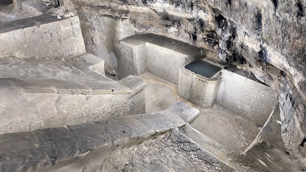
Borne routière sur la route militaire de Realp jusque dans le Witenwasserental. 5.5 kilomètres depuis Realp. La route a été construite dès 1920 pour protéger le Sud du pays de Mussolini qui a exigé que la frontière soit déplacée le long du Gothard.
Kilometersteine an der Militärstraße von Realp ins Witenwasserental. 5,5 Kilometer von Realp entfernt. Die Straße wurde ab 1920 gebaut, um das Land vor Mussolini zu schützen, der verlangt hatte, dass die Grenze entlang des Gotthards verlegt werde.
Inscription : Km 5.5 | | |
Références : https://www.ivs.admin.ch/ ; https://www.rotondohuette.ch/erlebnisse-aktivitaeten/im-sommer/huettenweg-13
Website : https://umap.osm.ch/m/11134
📍 [Realp, UR](https://scaniver.se/L46.56667,8.49418)
Sketchfab
3D Model
Milestone Realp - Witenwasserental Km 5.5
Share:
AI-Powered Productivity
Boost your creative workflow with seamless access to ChatGPT, Claude, Midjourney and other global AI platforms. We recommendTongbaofor one-click access to AI tools and remote collaboration platforms. Get 200MB free daily upon registration, supports Google Workspace, Notion, and more.
Asset Information
Type:
3D Model
Source:
Sketchfab
Author:
clwackerProfile:
View on Sketchfab
Download:
Available
Published:
June 1, 2026
License:
CC Attribution-NonCommercial-ShareAlike
Commercial Use
Check License
View on Sketchfab
Statistics
Downloads:
0
Likes:
0
Views:
0
Technical Specifications
Polygons:
126,725
Vertices:
64,240
Categories