Sketchfab
3D Model
Arbor Low and Gibb Hill Map Peak District
License & Attribution
Description
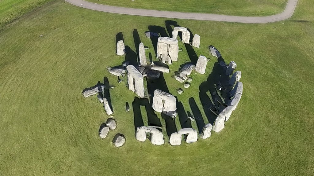
Georeferenced Orthomosaic Map and Model. The most important prehistoric site of the East Midlands, Arbor Low is a Neolithic henge monument atmospherically set amid high moorland. Within an earthen bank and ditch, a circle of some 50 white limestone slabs, all now fallen, surrounds a central stone ‘cove’ – a feature found only in major sacred sites. Nearby is enigmatic Gib Hill, a large burial mound.
Created in RealityScan by Epic Games from 814 images in 00h:03m:54s.
License: CC BY 4.0. Model created by Shiro Morturn - Sudbury Digital Imaging for documentation and educational purposes.
Sudbury Digital Imaging is working with Staffordshire Wildlife Trust on the Trent Valley Past and Present project, helping to connect communities with their heritage. (https://www.thetrentvalley.org.uk/projects/tvpp/)
Contour Map: 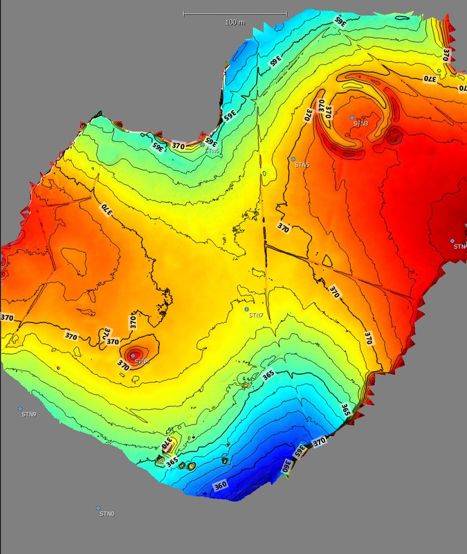
Scalerfield Image: 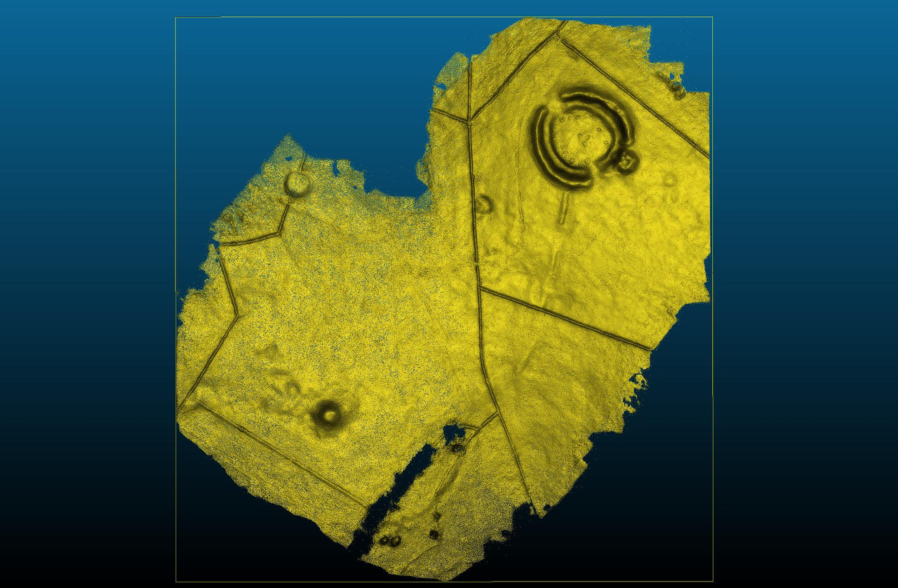
Sketchfab
3D Model
Arbor Low and Gibb Hill Map Peak District
Share:
AI-Powered Productivity
Boost your creative workflow with seamless access to ChatGPT, Claude, Midjourney and other global AI platforms. We recommendTongbaofor one-click access to AI tools and remote collaboration platforms. Get 200MB free daily upon registration, supports Google Workspace, Notion, and more.
Asset Information
Type:
3D Model
Source:
Sketchfab
Author:
Shiro MorturnProfile:
View on Sketchfab
Download:
Available
Published:
March 21, 2026
License:
CC Attribution
Commercial Use
Check License
View on Sketchfab
Statistics
Downloads:
5
Likes:
1
Views:
25
Technical Specifications
Polygons:
2,987,648
Vertices:
1,495,115
Categories