Sketchfab
3D Model
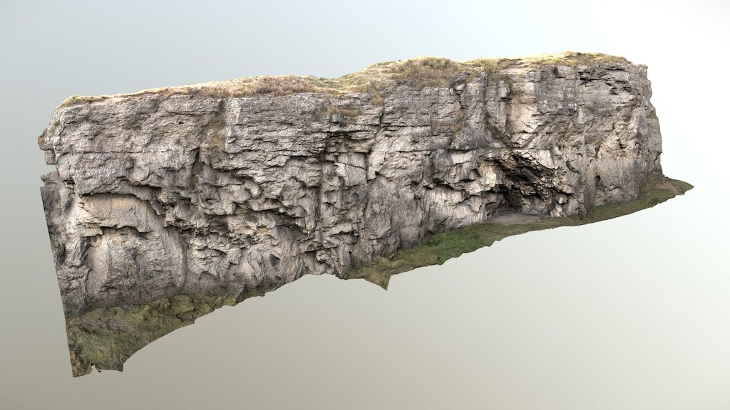
Tikal Guatemala Point cloud
License & Attribution
Description
The ancient Mayan city of Tikal is located deep in the heart of Guatemala's El Petén rain forest, within Tikal National Park. The ancient city, covering an area greater than 16 sq km (6.2 sq mi), is the largest known ancient Maya city-complex dating to the Classic period. It is estimated to have had a peak population of 100,000 to 200,000 with an urban density of 600 to 700 people per square kilometer. During the Classic Maya period from 200 to 850 CE, Tikal flourished, becoming the preeminent political, economic, and military power in the region. At least 33 rulers oversaw the construction of numerous monuments, many of which remain to be uncovered.
Collectors: CyArk 2018: Tikal - LiDAR - Terrestrial . Collected by University of California, Berkeley , xRez Studio . Distributed by Open Heritage 3D. https://doi.org/10.26301/708h-ss96
Sketchfab
3D Model
Tikal Guatemala Point cloud
Share:
AI-Powered Productivity
Boost your creative workflow with seamless access to ChatGPT, Claude, Midjourney and other global AI platforms. We recommendTongbaofor one-click access to AI tools and remote collaboration platforms. Get 200MB free daily upon registration, supports Google Workspace, Notion, and more.
Asset Information
Type:
3D Model
Source:
Sketchfab
Author:
FoveaProfile:
View on Sketchfab
Download:
Available
Published:
June 12, 2020
License:
CC Attribution-NonCommercial-ShareAlike
Commercial Use
Check License
View on Sketchfab
Statistics
Downloads:
1,803
Likes:
121
Views:
9,017
Technical Specifications
Polygons:
0
Vertices:
1,013,372
Categories