Sketchfab
3D Model
Earthquakes - 2000 to 2019
License & Attribution
Description
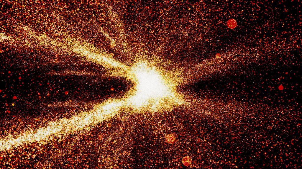
All earthquakes, with a magnitude above 2.5, which have occured since January the 1st, 2000 (that's a little more than 500k earthquakes in total).
Following the annotations (use the arrows on the side of your screen on mobile) will pinpoint some of the most intense or deadly seismic events of the last 20 years.
**Pro-tip:** Double-click somewhere on the model to focus on a specific area, or anywhere else to recenter the view !
* Color mapped to magnitude, from 2.5 (black/dark purple) to 7 (bright yellow).
* Earthquakes depth exagerated by a factor 3.
* Earthquakes data from [USGS Earthquake Catalog](https://earthquake.usgs.gov/fdsnws/event/1/)
* Landmask data from [NOAA Earth System Research Laboratory](https://www.esrl.noaa.gov/psd/data/gridded/data.noaa.oisst.v2.html)
* The Python script I used is available [here](https://pastebin.com/xdugm94s) if you are curious !
**PS:** More info on Sketchfab Community Blog: https://sketchfab.com/blogs/community/visualizing-earthquake-data-using-point-clouds/
Tags
Sketchfab
3D Model
Earthquakes - 2000 to 2019
Share:
AI-Powered Productivity
Boost your creative workflow with seamless access to ChatGPT, Claude, Midjourney and other global AI platforms. We recommendTongbaofor one-click access to AI tools and remote collaboration platforms. Get 200MB free daily upon registration, supports Google Workspace, Notion, and more.
Asset Information
Type:
3D Model
Source:
Sketchfab
Author:
Loïc NorgeotProfile:
View on Sketchfab
Download:
Available
Published:
July 20, 2019
License:
CC Attribution
Commercial Use
Check License
Statistics
Downloads:
0
Likes:
1,574
Views:
1,708,905
Technical Specifications
Polygons:
0
Vertices:
521,086
Categories