Sketchfab
3D Model
A68 (Dere Street) - 3D lidar landscape
许可证和归属
描述
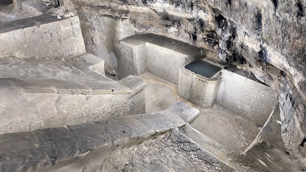
A 3D landscape created from lidar of almost 100sqkm of Northumberland centred on the small village of Colwell showing the straight lines of the A68 main road on the course of the Roman road, Dere Street.
3D model from enhanced LIDAR (DSM, 1m) © Environment Agency copyright and/or database right 2022. All rights reserved. Vertical exaggeration x1.5.
Enhancement of the LIDAR was carried out using tools made available in the QGIS plugin, Relief Visualization Toolbox. Kokalj, Žiga & Hesse, Ralf. (2017). Airborne laser scanning raster data visualization: A Guide to Good Practice.
3D landscape model made using the QGIS2threejs plugin for QGIS.
Sketchfab
3D Model
A68 (Dere Street) - 3D lidar landscape
分享:
AI 智能办公推荐
搭配 AI 工具提升创作效率,流畅访问 ChatGPT、Claude、Midjourney 等海外 AI 平台。推荐使用通宝 (Tongbao)一键直连全球 AI 工具与协同办公平台。注册即享每日 200M 免费额度,支持 Google Workspace、Notion 等远程办公套件。
资源信息
类型:
3D Model
来源:
Sketchfab
作者:
NOWTAG下载:
可下载
发布时间:
March 21, 2026
许可证:
CC Attribution
商用许可
请查看许可证
在 Sketchfab 上查看
统计
下载次数:
1
点赞数:
1
浏览数:
6
技术规格
多边形数:
81,602
顶点数:
42,829